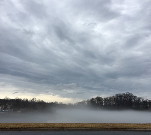
Showing posts with label clouds. Show all posts
Showing posts with label clouds. Show all posts
Wednesday, March 14, 2018

Friday, September 12, 2014
Website of the Week: NASA's S'COOL

If you are over the age of 5 and you like clouds, NASA's S'COOL website is the place for you. This citizen science project is designed to let student observers report cloud conditions and compare their findings with CERES satellite data (a fact sheet about CERES can be found here). Although this project is primarily designed for school classes, individuals can report their findings too. To date, over eighty countries have participated in this project!
There are some neat information sheets tucked into this website, including a cloud chart, tips for observing clouds, and more tips for observing clouds. Enjoy!
Sunday, September 7, 2014
Mackerel Sky
I love clouds. There's something alluring about their ephemeral beauty. Each morning, I look to the sky to see what surprises Mother Nature has in store for me.


Today, I found a mackerel sky. This is a cloudscape that looks like rows of fish scales, or, as I like to think of it, a popcorn sky.

Altocumulus
Technically, these rows of small puffy clouds are altocumulus, mid-level cumulus that form in the lower middle portion of the sky. These clouds are sometimes confused with cirrocumulus, although the two form in very different vertical layers. If you look through the bumpy rows of clouds and the sun looks fuzzy, you've spotted the rarer and higher lying cirrocumulus.

Cirrocumulus
Over on NASA's S'COOL website (Students' Cloud Observations On-line), Lin Chambers suggests holding your hand up at arm's length when trying to differentiate between these two cloud types. If the individual clouds are the size of your thumbnail, you have altocumulus; if they are the size of your pinky fingernail, you have cirrocumulus.
Note: Since I posted this, I've learned that the term mackerel sky can be used to describe either cirrocumulus or altocumulus or both!
[Edited 9/14/14]
Monday, July 14, 2008
Tail Clouds

I was watching the news the other night and saw a picture of a tail cloud. As an amateur sky-watcher, I was very interested, because I had never seen anything like it before. To me, a tail cloud looks kind of like a horizontal tornado, forming just above the ground. Storm chaser Mike Hollingshead of Extreme Instability does a better job of explaining it -- with great photographs -- on his Storm Glossary/Info page. I now know what a "Beaver Tail" and the "Bear's Cage" are, too!
Thursday, June 5, 2008
How big are raindrops?
 Photo credit: Leon Brooks, BurningWell.org
While I was taking out the trash the other night, I commented to my young son that it was misting outside.
He gave me a funny look and said, “It’s raining.”
I said, “No, it’s misting. It’s not coming down hard enough to be rain.” I started to tell him about the different ways that people might describe rain, like drizzle or light showers, but I stopped short.
How do we define rain? What are the actual meteorological classifications of liquid precipitation? I thought that this would be a simple question, but there's been some debate on the subject.
According to the National Oceanic and Atmospheric Association, drizzle consists of fine water droplets with diameters of less than 0.5 mm; rain is usually larger than 0.5 mm. Fog droplets are similar to drizzle, but they don’t hit the ground.
I found an older set of definitions from the U.S. Department of Agriculture, though the U.S. Geological Survey at The Water Cycle: Precipitation. The 1959 USDA table referenced on this site has definitions for precipitation that include fog, mist, drizzle, light rain, moderate rain, heavy rain, and cloudburst. Part of this table included the median diameters of different precipitation droplets, including 0.96 mm for drizzle and 1.24 mm on up for rain (note that these don't exactly match the NOAA definitions).
I couldn’t wrap my mind around the numbers, so I took the data about droplet sizes and made my own graph. I discovered a couple of interesting things when I sat down with the numbers.

First, none of the droplets are very big. Even the largest water droplet -- occurring during a cloudburst -- is extremely small, typically measuring less than 2/10 of an inch in diameter. (Now, I don’t know about you, but I’ve had raindrops fall in my eye and it’s hard for me to believe that they are usually so tiny.)
Second, comparing droplet sizes reveals enormous differences between the categories. Cloudburst droplets (at 2.85 mm in diameter) are over 200 times larger than fog droplets (0.01 mm in diameter).
How do scientists know these things? Here’s one way: In 1971, researcher Motoi Kumai went out into the fog armed with gelatin-coated glass slides and studied the results under an optical microscope. He measured the radii of about 20,000 fog droplets for his paper, published in the Journal of Atmospheric Sciences in 1973. (You can read Arctic Fog Droplet Size Distribution and Its Effect on Light Attenuation in the online journals at the American Meteorological Society. Interesting side note: Kumai found that long-lasting fogs have larger water droplets than short duration fogs.
So, how big are raindrops, anyway? See for yourself! The next time you see a storm brewing, take a piece of colored construction paper outside and lay it securely on the ground. Let the first few raindrops fall and then grab your paper and quickly run inside before you both get drenched. The water droplets should have made marks on your paper; you can take your own measurements. Do you think that your results will be the same or different than those found by the meteorologists? Why?
Wednesday, March 12, 2008
Send in the clouds
I have always been fascinated by clouds. One of the earliest science projects I completed for school was a diagram of the major cloud types consisting of an array of cotton balls on a blue construction paper background.
According to my handy Understanding Weather and Climate textbook from Aguado and Burt, our earliest cloud classification system had four types: cirrus (those thin wispy clouds that look like threads of cotton candy), stratus (flat, layered clouds that remind me of pancakes), cumulus (puffy clouds that look like balls of cotton) and nimbus (rain-producing clouds). Today, we group clouds according to both height and form, allowing for more detailed classification.

I took this photograph of the sky over the North Carolina coast near Beaufort in the early fall of 2007. I can tell these are cumulus clouds by their puffy shape. According to my textbook, I suspect they can be further classified as cumulus humilis, or fair weather cumulus.
Photographing clouds is a fun way to appreciate their beauty. Be sure to check out my favorite book on the subject, John A. Day's gorgeous table-top tome, The Book of Clouds. You can also visit Day's website, CloudmanTM.
According to my handy Understanding Weather and Climate textbook from Aguado and Burt, our earliest cloud classification system had four types: cirrus (those thin wispy clouds that look like threads of cotton candy), stratus (flat, layered clouds that remind me of pancakes), cumulus (puffy clouds that look like balls of cotton) and nimbus (rain-producing clouds). Today, we group clouds according to both height and form, allowing for more detailed classification.

I took this photograph of the sky over the North Carolina coast near Beaufort in the early fall of 2007. I can tell these are cumulus clouds by their puffy shape. According to my textbook, I suspect they can be further classified as cumulus humilis, or fair weather cumulus.
Photographing clouds is a fun way to appreciate their beauty. Be sure to check out my favorite book on the subject, John A. Day's gorgeous table-top tome, The Book of Clouds. You can also visit Day's website, CloudmanTM.
Subscribe to:
Posts (Atom)